Datainnsamling fra sjøen med ubemannede båter
Tryggere prøvetaking, høy datakvalitet og redusert behov for manuell innsats.


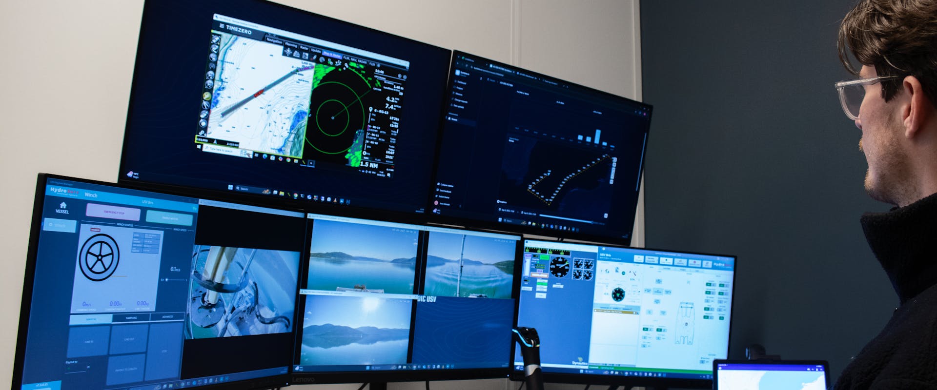
Ubemannede båter gir nye muligheter
Vi leverer datainnsamling og vannprøver fra sjøen ved hjelp av ubemannede båter (USV). Våre løsninger gir rådgivere og konsulenter et sikrere, raskere og mer kostnadseffektivt grunnlag for planlegging, prosjektering og miljøkartlegging.
Båter for krevende forhold
Våre USV'er er utviklet for sikker og effektiv datainnsamling i sjøen. De kan operere kontinuerlig i lange tidsperioder, også under krevende vær- og sjøforhold. Dette gir nye muligheter for omfattende og kostnadseffektiv innsamling av data, uten begrensningene bemannede båter og mannskap har.

Våre hovedtjenester innen datainnsamling fra sjøen
CTD-Profil
Profilering ned til 1500 meter med målinger av oksygenmetning, turbiditet og fluorescens. Gir et detaljert bilde av sjøens fysiske og kjemiske forhold, nyttig for modellering og miljøkartlegging.
Vannprøver
Prøvetaking fra flere steder på samme tokt, i dybder mellom 0 og 30 meter. Vi henter vannprøver fra 100-2000ml med høy kvalitet og effektivitet.
Siktedyp
Vi måler siktedyp med Secchi-skive og kamera for å avgjøre klarheten i vannet. Metoden er godkjent av Miljødirektoratet. En enkel, men effektiv metode for å dokumentere miljøforhold, endringer over tid og påvirkning fra inngrep.
Dette skiller oss fra tradisjonelle løsninger

Ofte stilte spørsmål
Her finner du svar på vanlige spørsmål. Finner du ikke det du leter etter, er du alltid velkommen til å ta kontakt!
Kystdata.io samler alt på ett sted, planlegging, bestilling og oppfølging av oppdrag. Det gir deg full oversikt og en smidigere arbeidsflyt. Les mer
Alle analyser utføres av vår partner Eurofins. Resultatene får du som kunde i Kystdata.io
I Kystdata.io får du et uforpliktende pristilbud som tilpasses hvert oppdrag. Tilbudet genereres automatisk rett etter bestilling.
Våre samarbeidspartnere